This post was a long time coming, since I actually visited Madras in February of this year. I was on a work trip and my co-workers graciously stopped and allowed me take photos on the way to and from the work site (Deer Ridge Correctional Institution).
First, a bit about Madras (pop. approx. 6,600). It’s pronounced Mad-ress (like “I’m mad!”) and not Maaah-dras like the shirt. Although it was quite possibly named after said shirts. Oh look, here’s a nice link to some history. Madras is located in Central Oregon, just east of the Cascades. It’s conveniently located on both Hwy 26 and Hwy 97, north of Bend and east of Portland. Madras is about a 2 hour drive from Portland.
Another interesting fact about Madras is that if you live here, your city tap water is the same H20 bottled for Earth20. It comes conveniently out of an obscenely large artesian aquifer called Opal Springs (doesn’t that sound nice?)
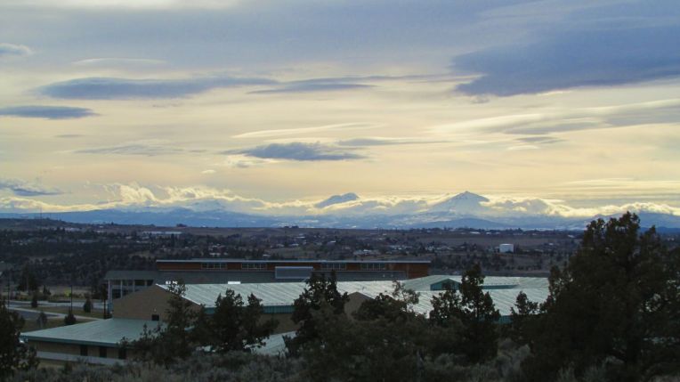
It’s very hard to convey the sheer mountain-osity here, so I’ll just show you some pictures.
Mt. Jefferson (right), the Three Sisters (left) and I think a butte of some sort.
This is what I saw from the ridge on the ride back to the hotel from the prison. It is a view from Ashwood Road going west-ish. I did make my co-worker stop on the side of the road so I could get this. The picture cannot convey what it feels like to see this. The mountains seem VERY CLOSE and big, and since you’re so high up on a ridge it seems like you could almost reach out aaaannnd….but you can’t. But it looks more like this when you’re there:
Mt. Jefferson and then another mountain behind that. It might be Washington.
I am not totally sure of which mountains these all are. I am familiar with Jefferson because it’s immense and you can see it from both sides of the Cascades. But I think we can all agree they are PRETTY NICE MOUNTAINS. Top choice.
Mt. Hood as seen from DRCI.
This is a fantastic shot of Mt. Hood taken from the prison early in the morning. You probably won’t come here when you visit and that’s just as well.
Here it is again from Highway 26, going west.
It’s really difficult to stop taking pictures of Mt. Hood.
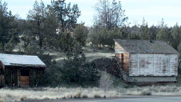
And some random pictures along the road.
BarnShedsTypical Madras landscape with sagebrush and more mountainsUbiquitous Central Oregon juniper trees
Sunrise from our hotel on the west side of town
If you go to Madras, a nice place to stay is the Cross Keys Station on Cedar (just off Highway 97). It is conveniently located across the street from a most excellent Mexican restaurant called Mazatlan, where you can get eye-watering Pollo Diablo and a virgin daiquiri.
Yes, you read it correctly. I did use the words “sunny”, “”Oregon” and “coast” all in one sentence.
We decided to take advantage of the clear skies to visit the Oregon Coast one last time before we return to work after our winter vacations.
We briefly considered Cannon Beach which is a beautiful, artsy town on the North Coast. However, it is a two hour drive from Salem and most of the accommodations demanded a 3-night stay for the holiday weekend.
After a few minutes on TripAdvisor, I chose the Travelodge in Depoe Bay. The price was reasonable and the lodge is within walking distance of shops and restaurants.
Depoe Bay is located on Hwy 101 between Lincoln City and Newport (home of the Oregon Aquarium). It’s about a 90 minute drive from Salem.
View from the Travelodge, Depoe Bay
The hotel was a pleasant surprise, considering the frugal room charge, this hotel has all ocean view rooms. We also had a gas fireplace in the room, which made it exceedingly cozy.
We arrived an hour early for check in and our room was ready- third floor, room 301, best view in the house.
Watching the surf break from the balcony
A bit too chilly for a picnic today, but this would be a really nice spot in Sept
Depoe Bay is the Whale Watching capitol of the Oregon Coast (at least that’s what they’re telling us here.) It is home to a state Whale Watch area where park rangers are supposed to assist you to locate whales out in the ocean. Also, we visited during a huge whale migration week (which I guess is like “fleet week”- but for whales.) HOWEVER, the whale watching station was closed. We didn’t see one damn whale. Then again, I’m not very patient.
Not a whale in sight
Depot Bay has several places that offer chartered boats and whale watching vessels that you can board to view whales close up out in the ocean.
People on this boat probably saw some whales
Like most coastal towns (probably everywhere), Depoe Bay features many shops pumping out salt water taffy by the ton. I’m still not eating it. There is an array of gift shops and a few art galleries and about 8 restaurants. These are all located within about 3 blocks. And that’s about it. Depoe Bay has a population of 1400, and boasts the world’s smallest navigable harbor.
Depot Bay, looking north
Shortly after arrival, we hit the town (such as it is).
Central Depot Bay
With no cloud cover, the days on the Central Coast are cold and brisk. The wind blowing in from the ocean is icy, even while standing in the bright but fairly weak and very low winter sun.
So we head back to the hotel to relax before cutting loose in Lincoln City which is about 13 miles north of Depoe Bay. Lincoln City is a very popular tourist destination for people who live in the Mid-Willamette Valley (Salem and neighbors) as the drive is just over an hour. With a population of about 8000 it’s an average size coastal town. One of the major draws of Lincoln City is the Chinook (shin-nook) Winds Casino, operated by the Confederated Tribes of the Siletz (Sil-lets).
And here it is in all of its glory as we approach it Friday night.
It was packed for the holiday weekend. A few notes about the casino should you choose to visit:
Smoking is still allowed indoors at tribal casinos because they are technically located in the sovereign nation of the tribal grounds and are therefore not subject to state laws. So it’s pretty smoky. If this is an issue for you, there is one small non-smoking area which tends to be very crowded. It was a pretty good night for me, I managed to hit it big on the penny slots (by which I mean I won $50 which IS a lot of pennies.)
Like most casinos, CW has a daily buffet which is best described as “OK” and occasionally as good as “not bad”. There is usually about an hour wait if you choose to pay up front for the buffet, so keep that in mind if you show up hungry.
We decided to gamble first and take our chances with late night Lincoln City dining options later. We ended up at Maxwell’s on the Coast, located on Hwy 101 in “downtown” Lincoln City.
Pic taken from Maxwell’s website, it was dark when we arrived
The best thing about Maxwell’s is that they are open really late and serve sandwiches and entrees 21-hours a day. We dine and head home.
The next day, we check out of our room and head back into town for breakfast and whale watching (still nothing).
Take a few more pictures…
Then we head south to Newport to check out the Historic Bayfront and the Devil’s Punchbowl.
This is not the Devil’s Punchbowl
This is one of my favorite place names on the coast, it’s pretty accurate too. It’s not as good as Cape Disappointment (it’s not bad, we were just really expecting MORE) but that’s much further north.
Aptly named cape
Well, hell. Devil’s Punchbowl is a bust, we miss the turn for the state park. So on to Agate Beach.
And finally Newport. Newport is about 12 miles south of Depoe Bay. It’s also a popular tourist area because of its Historic Bayfront, Yaquina Bay Lighthouse and the Oregon Aquarium. Newport is another average sized coastal city and also the Lincoln County seat.
And it has this really cool bridge
Which is maybe not as cool as Florence’s really cool bridge, but it’s definitely taller and scarier and over a lot more water.
Actually, we missed our turned onto the bayfront and that’s why we are on the bridge. Twice. If you want to go to the Aquarium, you’ll take this bridge. We’re not going to the aquarium today. Turns out, we’re also not going to lighthouse because we missed that turn too. No, no I’m not bitter.
We locate all the Mo’s in Newport. Mo’s is all over the Oregon Coast. People love their Mo’s. If you eat at a Mo’s (and let’s face it, if you’re traveling the Oregon coast you can hardly avoid it) you want the chowder.
We figure out the best place to get wasted (if you like that sort of thing).
We manage to locate the worst coffee in town and then go looking for sea lions.
Stinky and loud. I’ll be honest, they weren’t my favorite.
They are not hard to locate, they’re pretty loud.
This little guy was loving him some sun.
And stinky. And it’s cold.
So we head back to the car to go home.
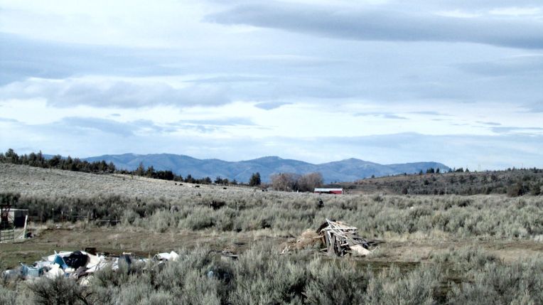
We drive east from Newport on Hwy 20 and 223 and wind through coastal range hills until we get back to the valley.
Trees for milesA neat red barn and a mountain. We think it’s Jefferson. We feel fairly confident about that.Christmas tree farm
Don’t forget to hit my TripAdvisor profile if you are interested in my local restaurant and hotel reviews.
I came across another Oregon blogger in southern Oregon which is an area that I love but don’t visit often since it’s an 8-hour round trip for me.
Anyhoo, please check out this post about Jacksonville, OR. I have a strong affection for it because I spent part of my honeymoon there.
Jacksonville is also home of the Britt Music Festival every summer. I’m actually surprises that more people in northwest Oregon don’t know about that. It is also just a loud shout form Ashland where the Feb-Nov Shakespeare Festival is held.
The conjunction between Jacksonville at night and Jacksonville in the day are remarkably peculiar and fascinating. When you first arrive there is a street filled with old-time essence and newcomer busyness. In the afternoon the streets are filled with curious and relaxed explorers venturing from one store to the next (resting only for a moment). The stores hide treasures from gentle quilts, to meditative gifts, from the quirky to the historical. Each shop giving you a distinct feeling from a warm wooded carvers resting place, to a friendly mother’s welcoming presence. The stimulation is both enticing and full of curious wit. Each store owner giving you a presentation of what they think is significant in life right at their store front.
At night Jacksonville becomes a local haven, a reflecting pool encompassed by business owners and calm folks within the bars and taverns. You are a stone’s throw away from…
Hello and welcome back to my post about Florence Oregon. It’s a jewel on the Oregon Coast (but not a “gem”, that distinction goes to Yachats, so sayeth their city sign.)
This is the final installment about Heceta Head Lighthouse. If you missed Part One, The Dunes and/or Part Two, Old Town you can follow the preceding links.
Heceta (pronounced ha-see-ta, or heck-i-ta or apparently ANY WAY YOU WANT) Head Lighthouse is an actual funtioning lighthouse and is considered to be the brightest light on the Oregon coast, being visible for 21 nautical miles. Which is great if you are out at sea and looking for a place to spend the night, then it would be easy to find.
We begin our hike up to the lighthouse from the parking at Heceta Head Lighthouse State Lookout Area (Oregon State Parks day pass required) down near the beach, below Highway 101, approximately 12 miles north of Florence.
Heceta Head Beach
Then we ascend the forest trail up to the lighthouse.
Trail to lighthouse
Then we catch our first glimpse of the Lightkeeper’s House, a privately run bed and breakfast that is owned and maintained by the U.S. Forest Service.
Lightkeeper’s House, Bed and Breakfast
And we continue…
Almost there…
And we arrive! At the lightkeeper’s house– not the lighthouse, sorry I got you all excited.
Lightkeeper’s House
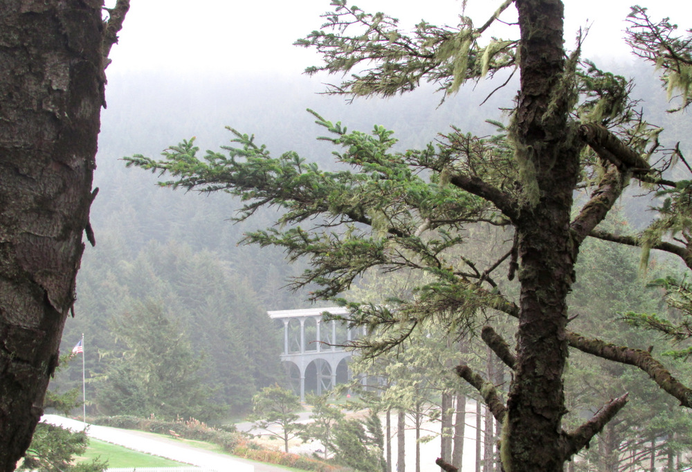
And we’re climbing…there it is!
Lighthouse
The trail up to the lighthouse is a very easy hike, approximately 1/2 mile from the parking lot to the lighthouse.
View of Highway 101 bridge from lighthouse trail
And now we’re really here.
Heceta Head Lighthouse
And I can prove it…
Lighthouse selfie
Here you can see the Fresnel lens which apparently was QUITE THE THING in lighthouse lenses..back in the day. The day in this case was 1894.
View of light deck and Fresnel lensPacific Ocean from Lighthouse lookout area
We consider briefly continuing on the trail up the cliff that leads to another lookout area then to a heavily wooded forest trail down to another beach (the Hobbit Trail), but we’ve arrived late and it will be dark soon. So we head back to the car.
Sun is finally coming out
And we’re back at the beach, but now the sun is out so I have to take more pictures…
BMW staring wistfully into the sunset…
We hop in the BMW and south to Florence. The Sea Lion Caves are a few miles down the road, but we do not stop there because they are CAVES and neither of us wants to be in one, cute sea lions notwithstanding.
This wraps up my three part blog series about Florence Oregon. I hope these (not bad!) photos and my (semi-accurate) descriptions have inspired you to visit the Central Oregon Coast.
If you have any questions please leave them in the comments section. Thanks for reading!
Welcome to Part Two of my post on Florence Oregon. (Part One, The Dunes is here.)
Florence is one of many super cute cities on the Oregon coast. Old Town is the historic downtown area located on the Suislaw (that’s SY-YOU-SLAW, not SU-SLAW, fyi) River, home of the Suislaw River Bridge, built in 1936 in all of it’s art deco/cathedral arch glory.
The Suislaw River is of course named after the Siuslaw indian tribe who were (SPOILER ALERT) forcibily removed from their sweet location by the river to the Siletz reservation up north. Now they have a casino just outside of Florence (which I’m sure fixes EVERYTHING): Three Rivers Casino. I’m a fan of a casino buffet but we ran out of time to visit this one.
The bridge looks something like this:
Suislaw River Bridge
So, yah, it’s a pretty nice bridge. Also, it’s a drawbridge. I know this because when I was in my hotel room at the nearby River House Inn I heard the horn signal that the bridge was opening to let a ship pass and mistook it for a tsunami warning. Thank goodness for the flashing lights on the bridge (saw them when I looked out the window to see if the condo residents next door were heading for the hills).
Other than that, my time in Florence Old Town was fairly relaxing (well, in comparison to the threat of imminent death by tidal wave.)
Old Town is cute. I hate to keep saying that but it’s PRETTY CUTE.
Old Town Florence, looking east. Restobar is on the left above red umbrellas- we ate there
It’s also fairly hip, but not too hip. We visited Forence in the middle of October when the weather on the Oregon coast is fairly mild, about 65 F(18.3C) and raining/cloudy/sunny, so pretty normal for fall. However we had previously stayed in Florence last year in July and the sun was out and the temperature was above 70.
Historic building in Old Town and Bridgewater Restaurant- we ate there.
Florence has an abundance of fabulous restaurants in Old Town, as well as several choices on Highway 101, which winds through town. Florence is typical of Oregon coastal cities in that the sidewalks roll up fairly early and on weeknights there are few establishments open later that 8pm, at least downtown. There are several family dining choices on the highway that are open later.
Secret Garden, Old Town
Old Town is situated on the north bank of the Siuslaw River, and river views dominate. You can’t really get away from that river.
City park, Old Town
Florence Old Town is completely walkable from wherever you park. We lodged at the River Inn just on the other side of the Suislaw River bridge and left the car parked for most of the weekend.
Bridge view from city park, featuring posing bird friend
Florence, like most coastal Oregon cities, has many art galleries and artisan shops. Most of the shops are open weekends and closed on Mon-Tues, Tues-Weds so keep that in mind if you are visiting during the week.
View of the main street from the river side. Several restaurants on Bay St offer river view dining.
Florence can be a very popular destination in the summer high season, so expect crowds and to pay more for lodging May through September. However, fall and winter can be an excellent time of year to visit. Many hotels run specials and the shops are still open on weekends (some coastal busniess owners do tend to take vacations and close their shops in December and January, but most are open year round).
Gazebo at the city park, Old Town
Florence has many annual events that might be amusing (I haven’t attended any).
The biggest draw is the Rhody Festival in May, followed by the Independence Day Celebration in July (we were in town for this in 2014 but were camping across the river and didn’t get to see the fireworksdisplay over the river. We heard them though; they sounded SPECTACULAR). Upcoming is the Florence Folk Music Festival which we are thinking about attending in January.
View of cathedral arches under the Siuslaw River Bridge
One of the things I noted while walking through town was the abundance of well-kept planting and flower beds. Coastal temperatures and frequent mist make this an ideal area for growing flowers if you’re, say, an individual who perhaps forgets to water frequently….
So that’s it for Old Town. If you are interested in my lodging and dining reviews of this area and others, please visit my TripAdvisor page. And stay tuned for Part Three, Heceta Head Lighthouse.
Florence Oregon is on the Central Coast, below Lincoln City/Newport and above Yachats. It’s popular mostly because of its location at the northern boundary of the Oregon Dunes National Recreation Area. If you ‘ve never been to Oregon you probably don’t know where any of that stuff is. So bascially it’s west of Eugene, right in the middle of the coastline. If that’s not helpful enough pull up a map. You seriously need to give me something to work with.
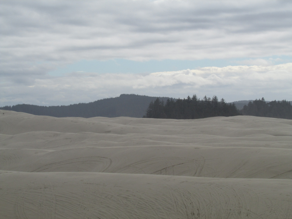
Let’s talk about the Dunes. First of all, they are nothing like what you are currently imagining (yes, I’m reading your mind.) They are part of coastal forest ecosystem and they go on for miles and if you don’t know what your doing or where you’re going you will get lost and possibily die there. NOW YOU REALLY WANT TO VISIT, RIGHT? I’m being dramatic, of course. You’ll probably make it out alive.
So you’re probably thinking, gee, that’s great an all, but let’s get on a DUNE BUGGY!! Here’s one:
Giant Dune Buggy
We’re ready to go!
We launch from here…right on Highway 101
And get on said highway, in the dune buggy obviously…
And drive to the South Jetty Dunes Staging Area…
With this guy behind me who had A LOT OF INFORMATION ABOUT EVERYTHING. A note about that: I got a lot of pictures of myself and others in the buggy (mainly my husband) in the side mirror as we were seated right behind the driver. If you book this trip, call early and ask for the seat NEXT to the driver, that’s the best one.
Yes, we’re going straight up that biggo sand hill in the above picture. Up to…here:
And now down into the forest trail to the Goose Pasture open sand dune area.
OHV Trail to open dune area and my husband
Apparently, this seagrass is European and was planted in the beginning of the 20th century in an attempt to keep the dunes from eroding, but apparently the seagrass is now taking over to point where many acres of dune year have been lost to the vegetation. I don’t how many, I wasn’t listening that closely because I was taking these AWESOME PICTURES:
Up the hill…
And there’s the Pacific Ocean, right where we suspected it would be!
Pacific Ocean and once again my husband
The temperature has dropped about 10 degrees and my hoodie suddenly seems foolish…
A helluva lot of sand and that handsome devil!
This picture with a sand rail in it gives you an idea of the scale of the dunes.
Tree island and sand rail
This is a witch’s eye, a dune with another dune springing out of it. Otherwise known as CALL FOR HELP, YOUR OHV IS STUCK. We were told experienced OHV drivers avoid these.
Witch’s EyeDunesView of the city of Florence from DunesView of the Pacific Ocean from the top of a dune
An unfortunate hat-loss incident. Fortunately, our informative driver Rick kindly turned around so my husband could retrieve it.
Hold on to your hat!!
Okay, so you get the idea: sand sand SAAAAAAAND. And of course trees, you can hardly get away from those in Oregon. Even on the beach.
And here we are covered in sand and ready to go back to the hotel for a nap and get ready for dinner in Old Town Florence, featured in my next post!
I thought I’d go ahead and get some weather Q and A out of the way.
Is Oregon a giant rain forest peopled by hippies and loggers?
No, it is mainly peopled by hipsters who dress like loggers. Also, the entire state is not actually wet. Really! The region to the west of the Cascade Mountain Range is coastal valley, hence the frequent rain and cloudy skies. The Eastern part of the state (conveniently located to the EAST of said mountains) is actually high desert and more similar to parts of Nevada and Idaho.
Really? That’s interesting! So how much rain does Oregon actually get? I heard it rains 9 months out of the year.
Salem receives an average of 47 inches of rain per year, Seattle 36, and Vancouver BC 57. Here’s a nifty chart that shows the seasonal pattern in Salem:
You can see it’s a “V” with most of the rain falling between October and June. Average rainfall for the state falls between 10 inches and 180 inches, increasing as you near the coast and/or go north.
You may now go ahead and be horrified for the people who get 180 inches, I am.
Yes, yes, that’s all very enlightening, but more importantly, does BigFoot live there?
This is where BigFoot lives. Do not be fooled by BigFoot wannabes and posers located throughout the rest of the US and Canada. Can we get back to the weather??
Whatever. So do people in Oregon use umbrellas? Or will I be laughed at by people on bicycles with tattoos?
People do, but not very many and not very often. It really depends on the type of rain and what direction it is falling and and how far they have to walk.
Wait!! There are types of rain???
Obviously. Here a few:
Mists– a refreshing spritz, more like really wet air. Moisture of this kind cannot be escaped and will soon permeate your garments down your socks (which will be encased in sandals).
Sprinkles– as the name implies, tiny drops, spaced fairly far apart, just enough to spatter your Elvis Costello glasses really good.
Light Rain– your ordinary, garden-variety rain. California gets this type of rain.
Moderate Rain– put your hood up– the one on your hoodie. Walk quickly.
Downpours– the heavens have opened up and are pouring gallons of water on you and all your stuff that your forgot to bring in . There is NO WAY you will stay dry through this unless you are wearing a wet suit or are dressed exactly like the Gorton’s Fisherman or possibly the crabbers on Deadliest Catch.
Freezing Rain– this is good times. The rain drops fall as water particles from the clouds, pass through the cooled air just above human habitation and then freeze en route to the ground, covering it a sheen of ice. It’s as fun as it sounds.
“Wintry Mix”– I see this on the local news a lot on January, it when it’s alllmost cold enough to snow, just around 33 degrees Fahrenheit, but still raining, and also snowing a little bit.
Hail– super hard rain, very popular in the spring, followed by weirdly bright sunshine.
Sideways– This is when an umbrella will fail you. It’s raining, fairly hard, and the cold wind is blowing it directly in your face, and it’s 40 degrees and everything SUCKS until you get to your car.
Sorry, I fell asleep during that. Does it get cold in Oregon? Does it snow?
It depends on your idea of cold. January in western Oregon is usually pretty cold (High 40/Low 32). In Eastern Oregon, more like 32/20. It snows in the mountains and in Eastern Oregon, it snows in Salem occasionally. No matter how much or how little snow falls you may be assured of one thing: schools will be CLOSED.
And what about Oregon beaches, is the weather nice there?
No one in Oregon goes to the “beach”, we go to the “coast”. Unless you already live on the coast, in which case that would be redundant. Coastal temps are generally between 50-65 degrees during the day, mostly cloudy and/or misty. Sometimes during a heatwave it will be warm and sunny and almost “beach-like” and you will be able to actually enter the ocean. However, because this information is available in local weather forecasts, you will likely spend most of the day in traffic…to and and from the coast on a tiny snake-trail of a highway. Plan accordingly. September and October are the warmest and sunniest months to visit the coast.
Speaking of clouds, do you ever see the SUN??
We do! Salem has about 77 clear days and another 80 or so that are partly sunny (please note, it’s never “partly cloudy”- glass half full, and all). That leaves about 200+ days that are mostly cloudy, but we get “sun breaks” on many of these days to remind us that we still live above ground. Also the cloud cover cover keeps the temperatures mild. Eastern and Southern Oregon have about 200 sunny days, but the temperatures there vary a lot more (colder in winter, warmer in summer).
Does it ever get “hot” in Oregon?
It does! In the summer you can expect temps of 80+ in most of Oregon (except the coast- it may be 80 there occasionally but one should never “expect” that). The recent El Nino conditions in the Pacific Ocean have given us our hottest summer on record with many days over 90 and 100. However, back in 2010/2011 we were in the La Nina Pacific Ocean phase in which we had very few days over 80 (and many lower). Let’s face it- the Pacific Ocean RULES us. Summer days are sunny and dry and beautiful and there is NO BETTER PLACE ON EARTH than Oregon in the summer.
That’s all I can think of for now. I hope it was enlightening. If you have any specific weather-related questions feel free to comment.