Florence, Oregon – The River, The Dunes And A Really Cool Bridge: Part Three, Heceta Head Lighthouse

Hello and welcome back to my post about Florence Oregon. It’s a jewel on the Oregon Coast (but not a “gem”, that distinction goes to Yachats, so sayeth their city sign.)

This is the final installment about Heceta Head Lighthouse. If you missed Part One, The Dunes and/or Part Two, Old Town you can follow the preceding links.

Heceta (pronounced ha-see-ta, or heck-i-ta or apparently ANY WAY YOU WANT) Head Lighthouse is an actual funtioning lighthouse and is considered to be the brightest light on the Oregon coast, being visible for 21 nautical miles. Which is great if you are out at sea and looking for a place to spend the night, then it would be easy to find.

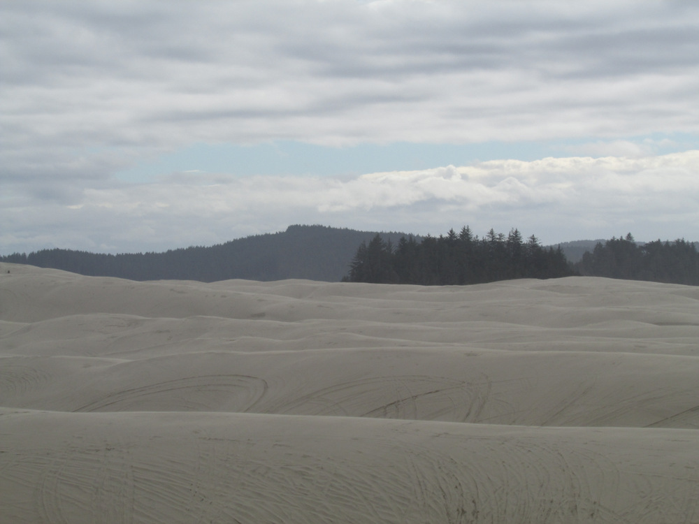
We begin our hike up to the lighthouse from the parking at Heceta Head Lighthouse State Lookout Area (Oregon State Parks day pass required) down near the beach, below Highway 101, approximately 12 miles north of Florence.

Heceta Head Beach
Heceta Head Beach

Then we ascend the forest trail up to the lighthouse.

09-IMG_0349
Trail to lighthouse

10-IMG_0350 13-IMG_0354 14-IMG_0355

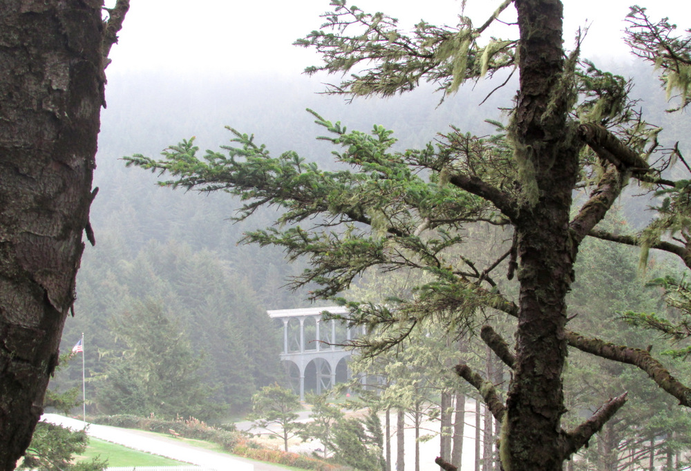
Then we catch our first glimpse of the Lightkeeper’s House, a privately run bed and breakfast that is owned and maintained by the U.S. Forest Service.

Lightkeeper's House, Bed and Breakfast
Lightkeeper’s House, Bed and Breakfast

And we continue…

17-IMG_0359 19-IMG_0362 74-IMG_0364-1

Almost there…

24-IMG_0368

And we arrive! At the lightkeeper’s house– not the lighthouse, sorry I got you all excited.

Lightkeeper's House
Lightkeeper’s House

And we’re climbing…there it is!

Lighthouse
Lighthouse

The trail up to the lighthouse is a very easy hike, approximately 1/2 mile from the parking lot to the lighthouse.

30-IMG_0374
View of Highway 101 bridge from lighthouse trail

36-IMG_0382 35-IMG_0380 31-IMG_0375

And now we’re really here.

37-IMG_0383
Heceta Head Lighthouse

And I can prove it…

40-IMG_0391
Lighthouse selfie

Here you can see the Fresnel lens which apparently was QUITE THE THING in lighthouse lenses..back in the day. The day in this case was 1894.

43-IMG_0394
View of light deck and Fresnel lens
44-IMG_0395
Pacific Ocean from Lighthouse lookout area

We consider briefly continuing on the trail up the cliff that leads to another lookout area then to a heavily wooded forest trail down to another beach (the Hobbit Trail), but we’ve arrived late and it will be dark soon. So we head back to the car.

48-IMG_0402
Sun is finally coming out

46-IMG_0400 52-IMG_0408 54-IMG_0410 56-IMG_0413

50-IMG_0406

And we’re back at the beach, but now the sun is out so I have to take more pictures…

67-IMG_0424 68-IMG_0425 69-IMG_0426

66-IMG_0423
BMW staring wistfully into the sunset…

We hop in the BMW and south to Florence. The Sea Lion Caves are a few miles down the road, but we do not stop there because they are CAVES and neither of us wants to be in one, cute sea lions notwithstanding.

This wraps up my three part blog series about Florence Oregon. I hope these (not bad!) photos and my (semi-accurate) descriptions have inspired you to visit the Central Oregon Coast.

If you have any questions please leave them in the comments section. Thanks for reading!

Florence, Oregon – The River, The Dunes, and a Really Cool Bridge: Part Two, Old Town

Welcome to Part Two of my post on Florence Oregon. (Part One, The Dunes is here.)

Florence is one of many super cute cities on the Oregon coast. Old Town is the historic downtown area located on the Suislaw (that’s SY-YOU-SLAW, not SU-SLAW, fyi) River, home of the Suislaw River Bridge, built in 1936 in all of it’s art deco/cathedral arch glory.

The Suislaw River is of course named after the Siuslaw indian tribe who were (SPOILER ALERT) forcibily removed from their sweet location by the river to the Siletz reservation up north. Now they have a casino just outside of Florence (which I’m sure fixes EVERYTHING): Three Rivers Casino. I’m a fan of a casino buffet but we ran out of time to visit this one.

The bridge looks something like this:

Suislaw River Bridge

So, yah, it’s a pretty nice bridge. Also, it’s a drawbridge. I know this because when I was in my hotel room at the nearby River House Inn I heard the horn signal that the bridge was opening to let a ship pass and mistook it for a tsunami warning. Thank goodness for the flashing lights on the bridge (saw them when I looked out the window to see if the condo residents next door were heading for the hills).

Other than that, my time in Florence Old Town was fairly relaxing (well, in comparison to the threat of imminent death by tidal wave.)

Old Town is cute. I hate to keep saying that but it’s PRETTY CUTE.

Old Town Florence, looking east
Old Town Florence, looking east. Restobar is on the left above red umbrellas- we ate there

It’s also fairly hip, but not too hip. We visited Forence in the middle of October when the weather on the Oregon coast is fairly mild, about 65 F(18.3C) and raining/cloudy/sunny, so pretty normal for fall. However we had previously stayed in Florence last year in July and the sun was out and the temperature was above 70.

Historic building in Old Town
Historic building in Old Town and Bridgewater Restaurant- we ate there.

Florence has an abundance of fabulous restaurants in Old Town, as well as several choices on Highway 101, which winds through town. Florence is typical of Oregon coastal cities in that the sidewalks roll up fairly early and on weeknights there are few establishments open later that 8pm, at least downtown. There are several family dining choices on the highway that are open later.

Secret Garden, Old Town

Old Town is situated on the north bank of the Siuslaw River, and river views dominate. You can’t really get away from that river.

City park, Old Town
City park, Old Town

Florence Old Town is completely walkable from wherever you park. We lodged at the River Inn just on the other side of the Suislaw River bridge and left the car parked for most of the weekend.

Bridge view from city park, featuring posing bird friend

Florence, like most coastal Oregon cities, has many art galleries and artisan shops. Most of the shops are open weekends and closed on Mon-Tues, Tues-Weds so keep that in mind if you are visiting during the week.

On the River, Old Town
View of the main street from the river side. Several restaurants on Bay St offer river view dining.

Florence can be a very popular destination in the summer high season, so expect crowds and to pay more for lodging May through September. However, fall and winter can be an excellent time of year to visit. Many hotels run specials and the shops are still open on weekends (some coastal busniess owners do tend to take vacations and close their shops in December and January, but most are open year round).

032-IMG_0325
Gazebo at the city park, Old Town

Florence has many annual events that might be amusing (I haven’t attended any).

The biggest draw is the Rhody Festival in May, followed by the Independence Day Celebration in July (we were in town for this in 2014 but were camping across the river and didn’t get to see the fireworksdisplay over the river. We heard them though; they sounded SPECTACULAR). Upcoming is the Florence Folk Music Festival which we are thinking about attending in January.

039-IMG_0332
View of cathedral arches under the Siuslaw River Bridge

One of the things I noted while walking through town was the abundance of well-kept planting and flower beds. Coastal temperatures and frequent mist make this an ideal area for growing flowers if you’re, say, an individual who perhaps forgets to water frequently….

002-IMG_0283 006-IMG_0288 019-IMG_0301 021-IMG_0303 022-IMG_0304

So that’s it for Old Town. If you are interested in my lodging and dining reviews of this area and others, please visit my TripAdvisor page. And stay tuned for Part Three, Heceta Head Lighthouse.

Florence, Oregon – The River, The Dunes, and a Really Cool Bridge: Part One, The Dunes

Florence Oregon is on the Central Coast, below Lincoln City/Newport and above Yachats. It’s popular mostly because of its location at the northern boundary of the Oregon Dunes National Recreation Area. If you ‘ve never been to Oregon you probably don’t know where any of that stuff is. So bascially it’s west of Eugene, right in the middle of the coastline. If that’s not helpful enough pull up a map. You seriously need to give me something to work with.

Let’s talk about the Dunes. First of all, they are nothing like what you are currently imagining (yes, I’m reading your mind.) They are part of coastal forest ecosystem and they go on for miles and if you don’t know what your doing or where you’re going you will get lost and possibily die there. NOW YOU REALLY WANT TO VISIT, RIGHT? I’m being dramatic, of course. You’ll probably make it out alive.

51-IMG_0485

So you’re probably thinking, gee, that’s great an all, but let’s get on a DUNE BUGGY!! Here’s one:

Giant Dune Buggy
Giant Dune Buggy

We’re ready to go!

55-IMG_0435-001

We launch from here…right on Highway 101

06-IMG_0438

And get on said highway, in the dune buggy obviously…

07-IMG_0439

And drive to the South Jetty Dunes Staging Area…

08-IMG_0440

With this guy behind me who had A LOT OF INFORMATION ABOUT EVERYTHING. A note about that: I got a lot of pictures of myself and others in the buggy (mainly my husband) in the side mirror as we were seated right behind the driver. If you book this trip, call early and ask for the seat NEXT to the driver, that’s the best one.

Yes, we’re going straight up that biggo sand hill in the above picture. Up to…here:

09-IMG_0442

And now down into the forest trail to the Goose Pasture open sand dune area.

OTV Trail to open dune area
OHV Trail to open dune area and my husband

Apparently, this seagrass is European and was planted in the beginning of the 20th century in an attempt to keep the dunes from eroding, but apparently the seagrass is now taking over to point where many acres of dune year have been lost to the vegetation. I don’t how many, I wasn’t listening that closely because I was taking these AWESOME PICTURES:

Up the hill…

18-IMG_0452

And there’s the Pacific Ocean, right where we suspected it would be!

16-IMG_0450
Pacific Ocean and once again my husband

The temperature has dropped about 10 degrees and my hoodie suddenly seems foolish…

22-IMG_0456
A helluva lot of sand and that handsome devil!

This picture with a sand rail in it gives you an idea of the scale of the dunes.

Tree island
Tree island and sand rail

This is a witch’s eye, a dune with another dune springing out of it. Otherwise known as CALL FOR HELP, YOUR OHV IS STUCK. We were told experienced OHV drivers avoid these.

36-IMG_0470
Witch’s Eye
33-IMG_0467
Dunes
View of the city of Florence from Dunes
54-IMG_0488
View of the Pacific Ocean from the top of a dune

An unfortunate hat-loss incident. Fortunately, our informative driver Rick kindly turned around so my husband could retrieve it.

Hold on to your hat!!

48-IMG_0482 49-IMG_0483 50-IMG_0484

Okay, so you get the idea: sand sand SAAAAAAAND. And of course trees, you can hardly get away from those in Oregon. Even on the beach.

And here we are covered in sand and ready to go back to the hotel for a nap and get ready for dinner in Old Town Florence, featured in my next post!

Covered in sand
Covered in sand